
SeaVision
by Vesseldove
Get uninterrupted vessel tracking with Vesseldove SeaVision Suite. Track vessels in real-time with the most advanced AIS and satellite data and ensure that no vessel is out of sight. Optimize decision-making and operational efficiency with advanced chart layers, voyage density maps and weather tracking.
Map Type & Layer Customization
Gain complete control over your maritime tracking experience with Vesseldove's customizable map types and layers. From satellite views to maritime navigation charts, tailor the display to suit your operational needs. Effortlessly switch between layers for a comprehensive overview of vessel movements, weather patterns, and voyage density.
Multiple map views for enhanced clarity
Real-time tracking with weather and voyage density layers


Unlock advanced map layers and tracking capabilities with Vesseldove.

1.5M+
All Type Vessel
200K+
Company
20M+
Company & Vessel Details

Satellite & Satellite V2
Experience real-time high-resolution satellite imagery for accurate geographical insights – ideal for monitoring sea conditions and tracking vessels with precision. In addition, enjoy the enhanced Satellite V2 mode, which offers faster load times and improved image clarity, supporting precise navigation and operational analysis.

Dark Map
Utilize the Dark Map mode for optimal viewing in low-light environments. This style minimizes glare while highlighting essential navigational elements for safe operations.

Ocean Map
The Ocean view emphasizes marine topography, showcasing underwater structures and oceanographic features. Perfect for deep-sea operations and research-oriented tasks.

Light Map
Enjoy a clean and minimalistic Light Map interface designed for high readability during daytime operations. This view offers straightforward navigation with clear visual elements.

Nautical Charts Plus
Nautical Charts Plus delivers detailed maritime charts complete with updated navigational aids, hazard markers, and route planning tools. Ensure safe and efficient voyages with this comprehensive resource.
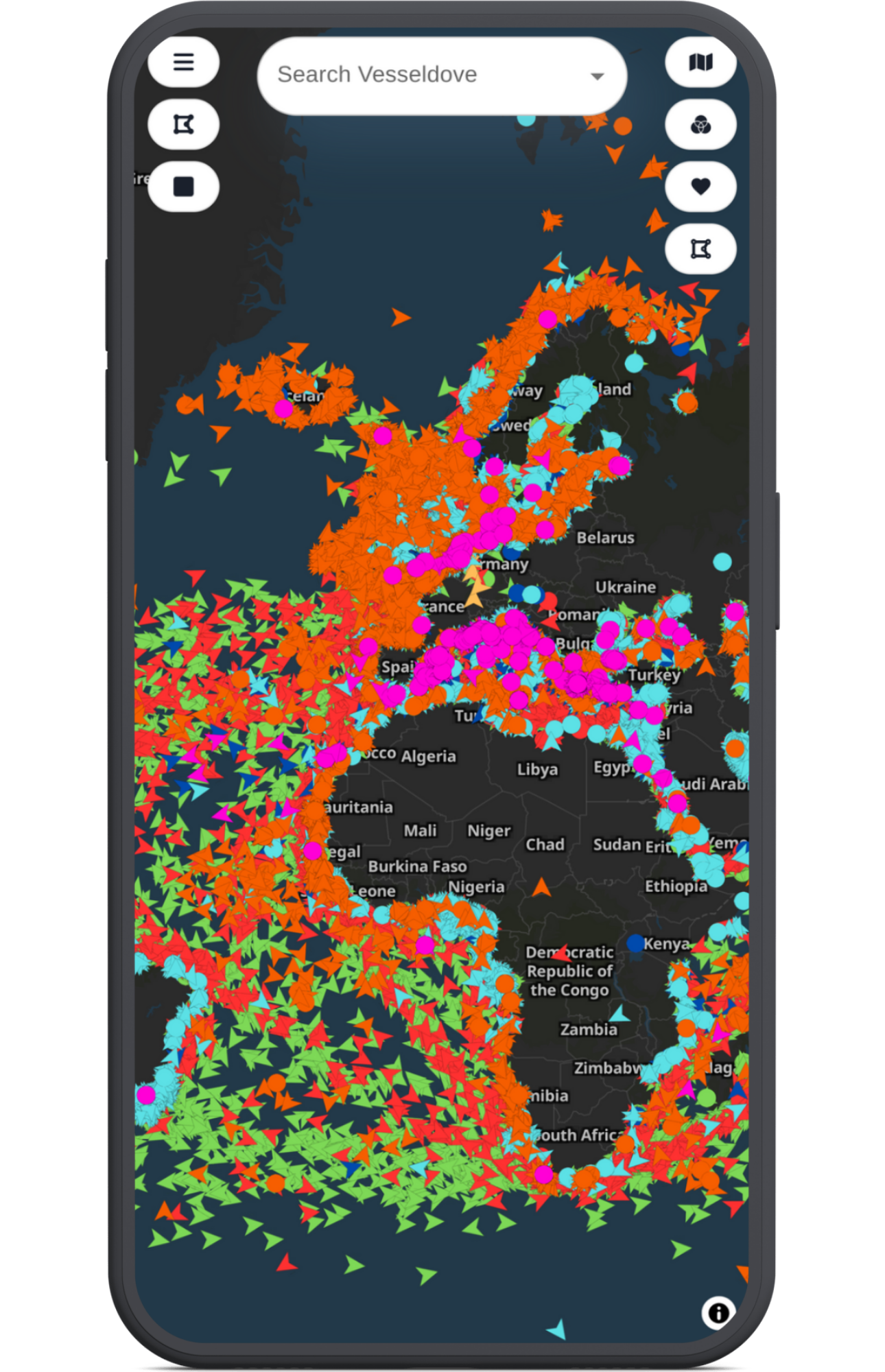
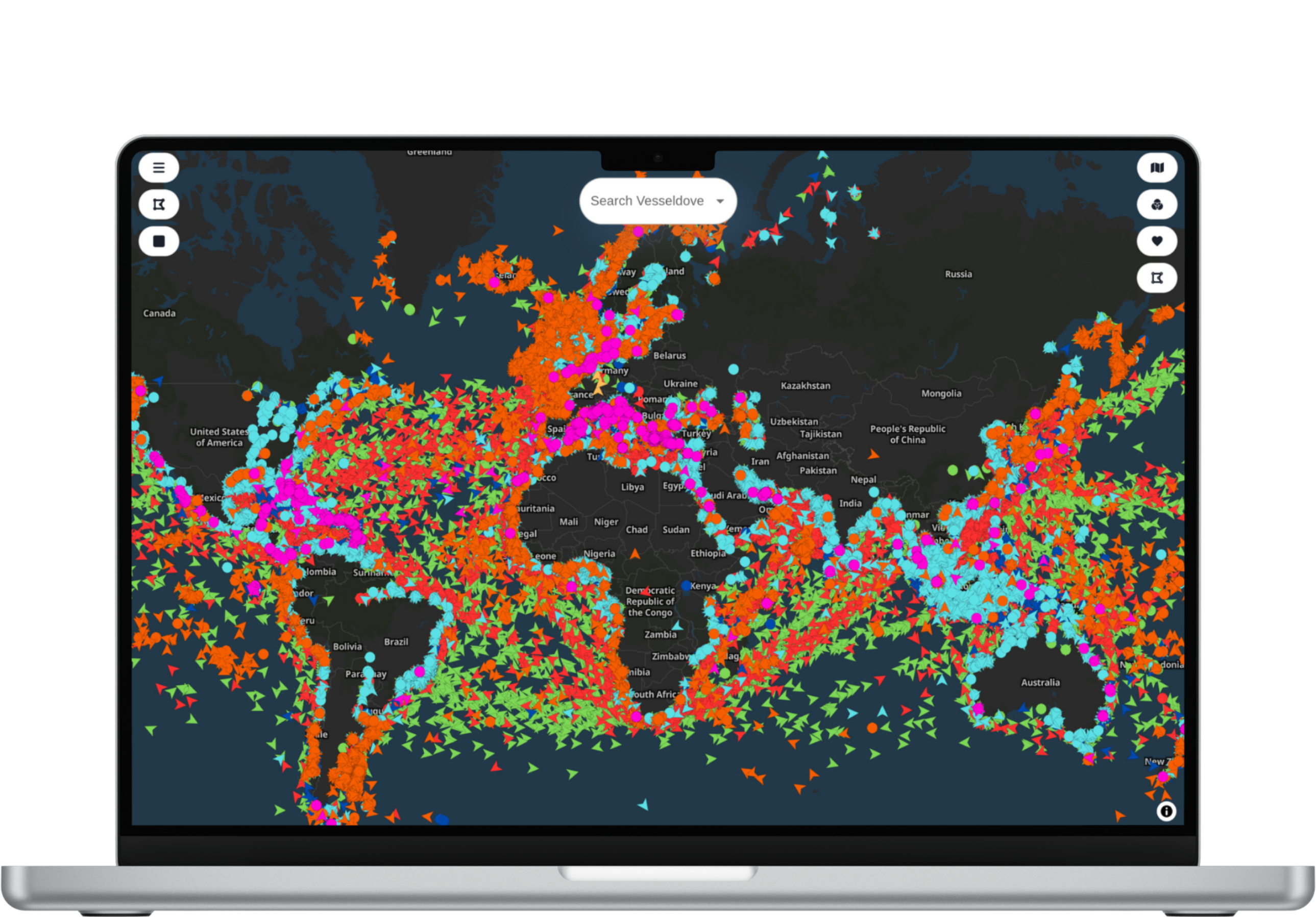
Vessel Tracking Map With Satellite Based
Get real-time vessel tracking with satellite-based AIS & S-AIS data. Our vessel tracking map provides you with the most accurate and up-to-date information on the location of vessels around the world.
 Real-time vessel tracking
- Satellite-based AIS & S-AIS data
- Accurate & up-to-date information
- Location of vessels around the world
- No Dead Zones

Maritime Map Layers: Everything is Just a Moment Away
Explore dynamic layers of nautical charts. With just a glance, access basic navigation, air and sea traffic.
Navigation Layers
Weather Layers
Traffic Analysis
Your Gateway to the World
The Port Layer includes the Ship Types Layer, the Nautical Marks Layer and the Zone Layer. It provides critical information for the identification of ports, ship categories, navigation marks and designated maritime zones

Sea Vision Features Overview
Discover how you can enhance the efficiency of your maritime operations with our advanced vessel filtering, fleet management, and area selection tools. Our solutions, supported by real-time data and analytics, empower you to make informed decisions.
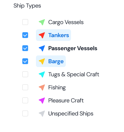


Vessel Filters
Unlock maritime searches with Vessel Filters. Filter vessels by type, capacity, fuel efficiency, and status. Access detailed voyage histories and safety records with real-time data and interactive mapping.
- Real-time vessel tracking
- Satellite-based AIS & S-AIS data
- Accurate vessel info
- Global vessel locations
- Zero dead zones
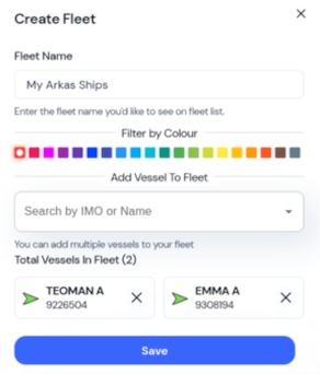
My Fleet
Manage your maritime assets effortlessly with My Fleet. Track vessels in real time, set maintenance alerts, and leverage analytics to optimize routes and boost efficiency.
- Comprehensive fleet overview
- Real-time vessel status
- Timely maintenance alerts
- Optimized route planning
- Historical performance data

Area Selection
Enhance maritime monitoring with Area Selection. Define custom geographic zones to access real-time and historical vessel data, receive instant alerts, and use predictive analytics for proactive decision-making.
- Custom geographic zones
- Predictive analytics
- Historical vessel data
- Real-time alerts
- Instant email notifications
Voyage Route
Transform your maritime operations with our innovative Voyage Route system. Harness the power of voyage route to monitor vessels, access comprehensive historical data, and receive real-time alerts.
- Voice-activated controls
- Real-time voice alerts
- Access to historical vessel data
- Instant voice notifications
- Predictive analytics for maritime safety
